


Map of Israel from Three Perspectives
Map of Israel from Three Perspectives
- Laminated
- Edited by cartographer Avigdor Orgad
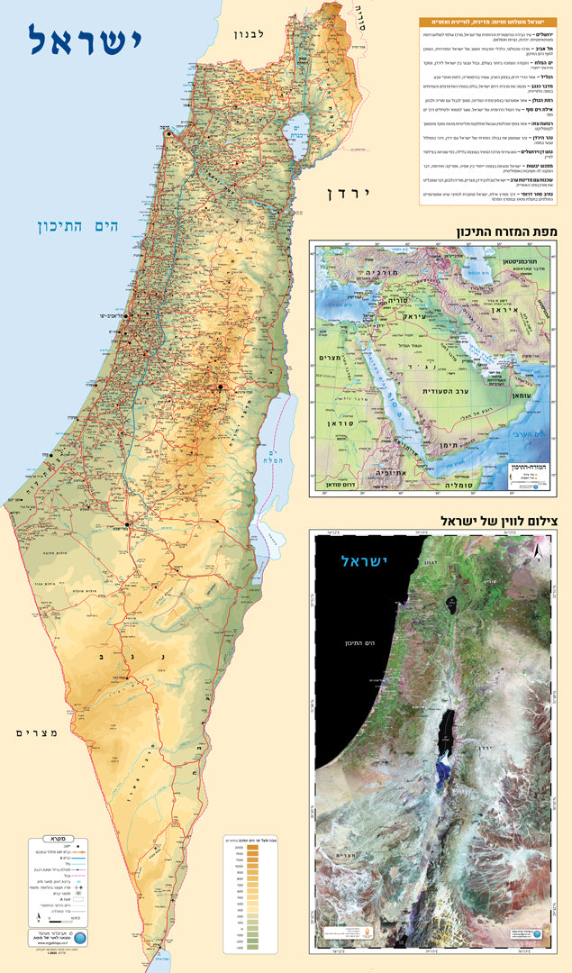
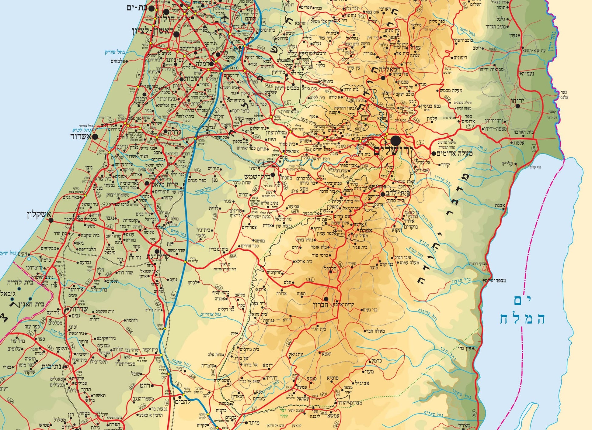
When you look at a map of Israel, for a moment everything seems familiar : the cities, the roads, the borders. But when that country appears in a satellite photo as part of the Middle East, the picture expands, deepens, and changes.
The combined poster offers three layers of perspective:
The physical map highlights the physical and political structure of Israel,
Satellite imagery reveals the true topography and landscape, without borders, and the regional map places Israel in the broader geographical context in which it lives and breathes.
In addition to being educational tools, it is also an opportunity for broader geographical thinking : learning not only where things are, but also how they connect to each other .
In the classroom or at home, this map invites not only observation but also conversation.
**It is not possible to order a map glued to a cover, including lists.
Couldn't load pickup availability