


Political world map in Hebrew
Political world map in Hebrew
- Political world map
- Update 2025
- Manulife
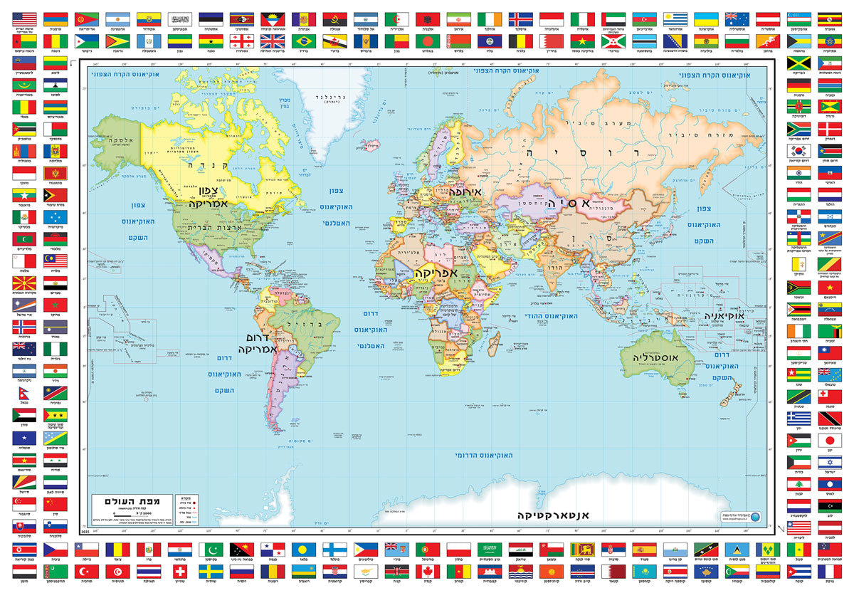
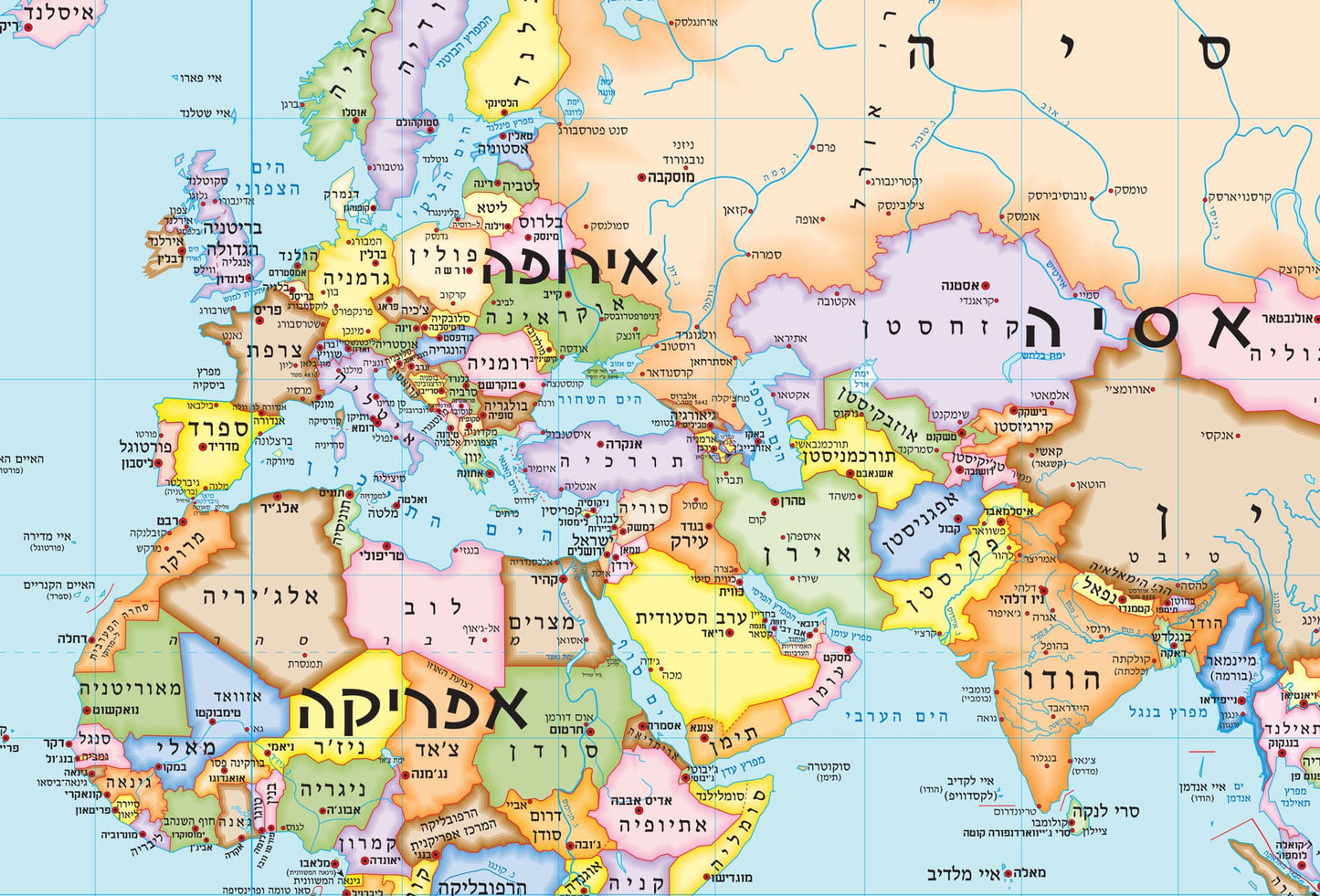
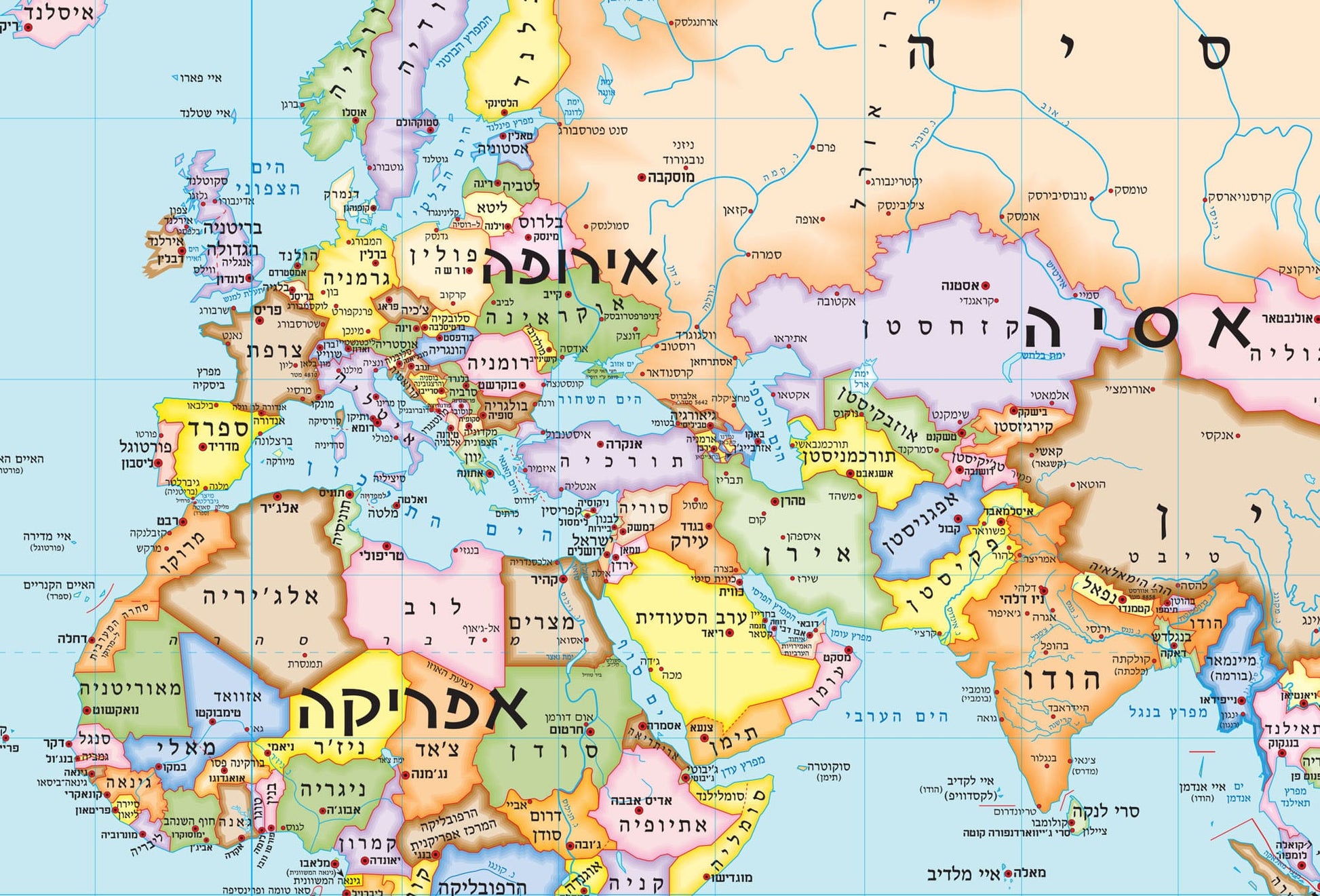
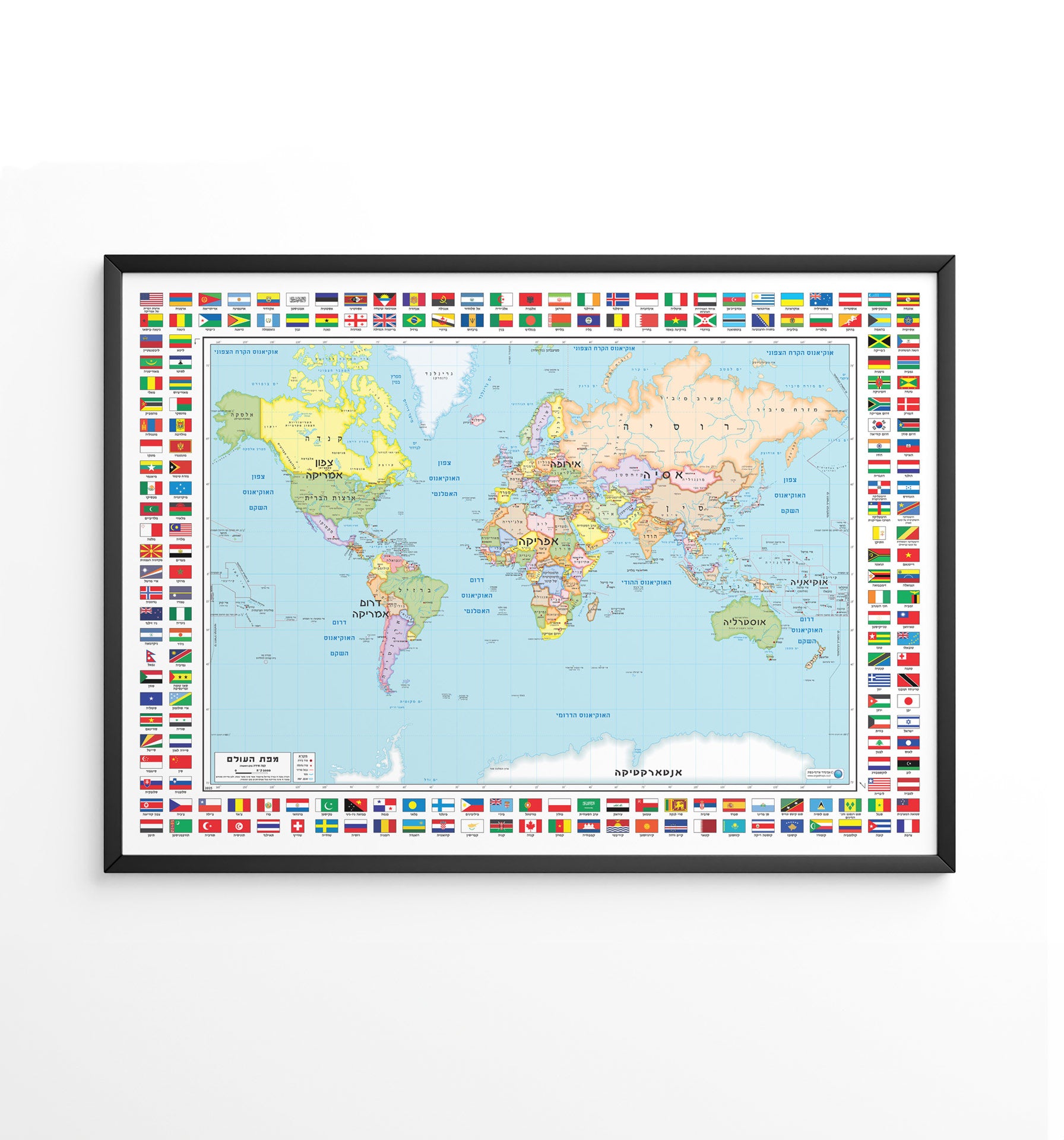
A political world map in Hebrew showing all the countries of the world in clear colors with political borders, capitals and major cities.
The map also includes country flags and makes it easy to understand the geographical division of the world. The clear and colorful design makes it a perfect tool for studying geography and exploring the world.
This map is suitable for hanging in the home, classroom, office or children's room and is an excellent learning tool for children, students and geography enthusiasts.
Suitable for:
• Studying geography
• Educational wall decoration
• Schools and classrooms
• Children's rooms and map enthusiasts
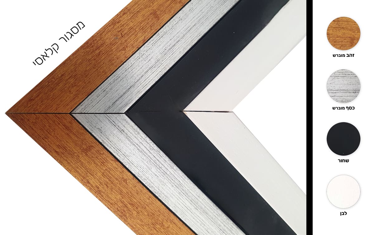
*Framed and/or mounted maps cannot be sent by registered mail.
**It is not possible to order a map glued to a cover, including lists.
Couldn't load pickup availability