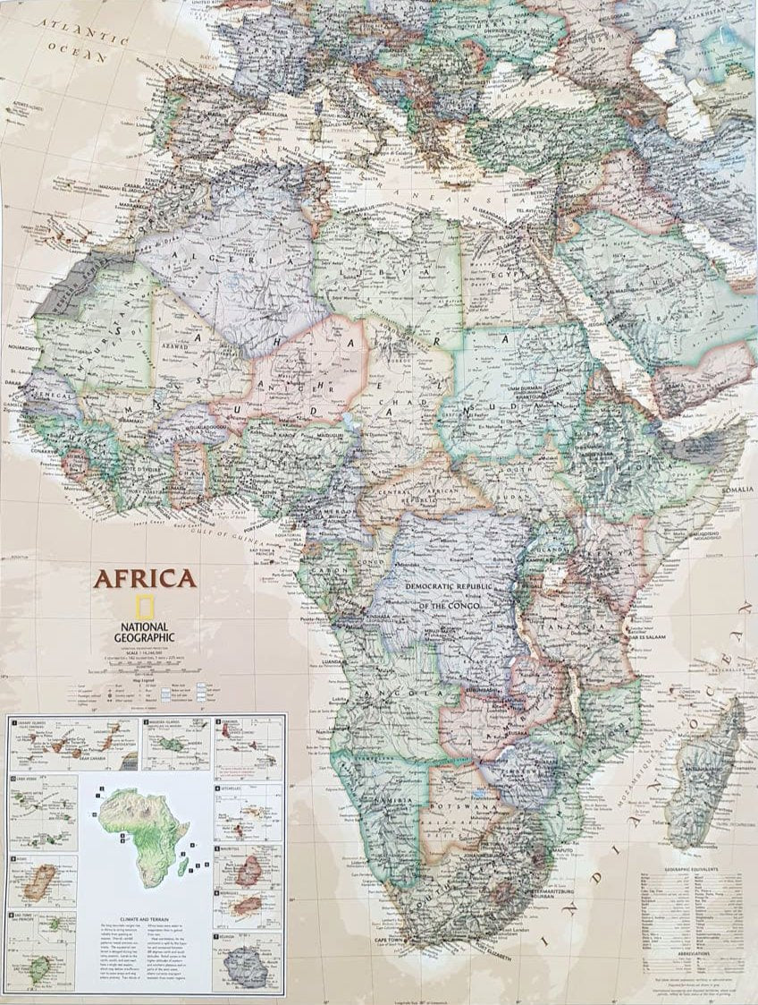
Antique Style Map of Africa
Antique Style Map of Africa
- The map is in English
- Size 80x60 cm
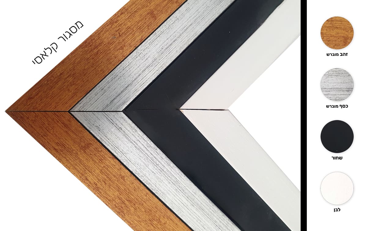
- Laminated
- National Geographic
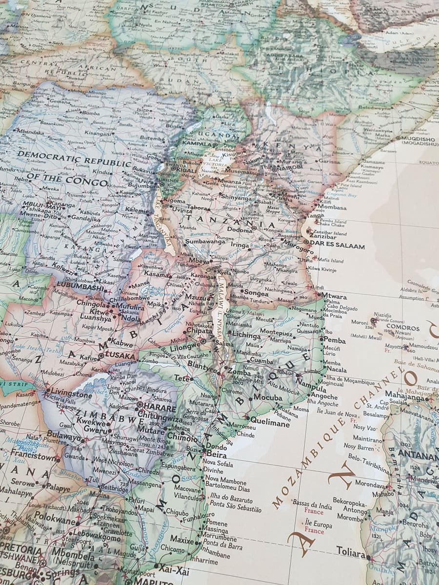
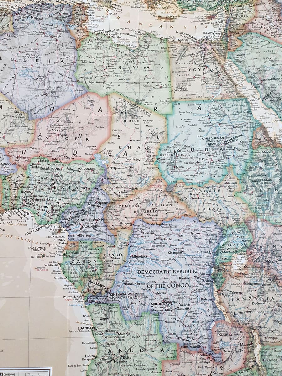
National Geographic's map of Africa is detailed and shows water sources, airports, roads, volcanoes, swamps, dry salt lakes, deserts, and underwater areas.
The map covers the following countries, their capitals and major cities: Algeria, Angola, Benin, Botswana, Burkina Faso, Burundi, Cameroon, Cape Verde, Central African Republic, Chad, Democratic Republic of Congo, Republic of Congo, Ivorian, J Ivory Coast, Egypt, Equatorial Guinea, Eritrea, Ethiopia, Gabon, Gambia, Ghana, Guinea, Guinea-Bissau, Kenya, Liberia, Libya, Madagascar, Malawi, Mali, Mauritania, Morocco, Mozambique, Namibia, Niger, Nigeria, Rwanda , Senegal, Sierra Leone, Somalia, South Africa, Sudan, South Sudan, Tanzania, Togo, Tunisia, Uganda, Zambia and Zimbabwe. The island countries shown are: Canary Islands, Madeira Islands, Comoros, Seychelles, Mauritius, Rodrigues, Reunion, Sao Tome and Principe, Bioco and Cape Verde.
* It is not possible to send framed and/or pasted maps by registered mail.
**It is not possible to order a map pasted on Kappa including lists.
Couldn't load pickup availability