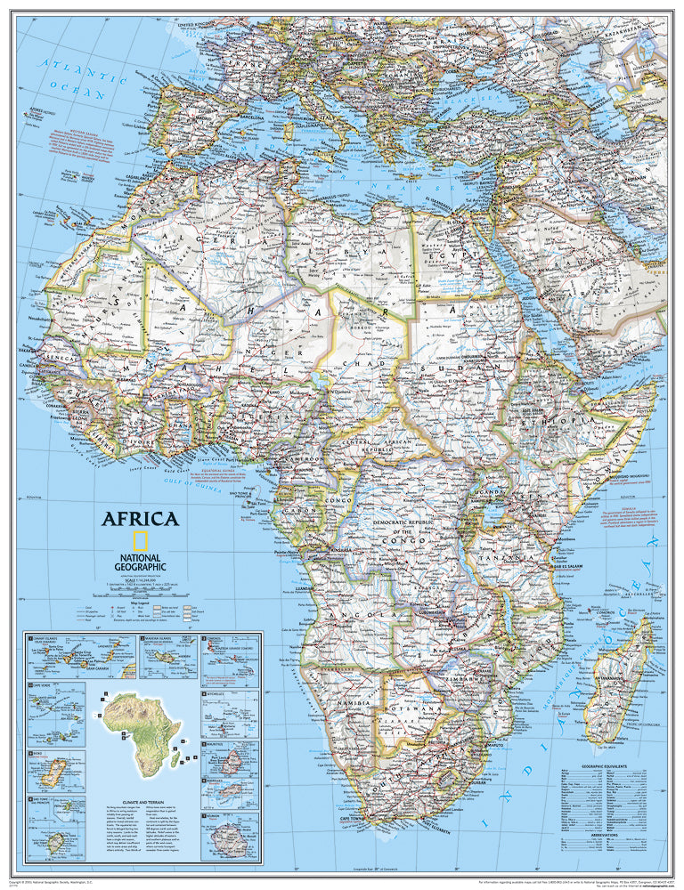
Africa Map
Africa Map
- The map is in English
- Laminated
- National Geographic
The map covers the following countries, their capitals and major cities: Algeria, Angola, Benin, Botswana, Burkina Faso, Burundi, Cameroon, Cape Verde, Central African Republic, Chad, Democratic Republic of Congo, Republic of Congo, Ivorian, J Ivory Coast, Egypt, Equatorial Guinea, Eritrea, Ethiopia, Gabon, Gambia, Ghana, Guinea, Guinea-Bissau, Kenya, Liberia, Libya, Madagascar, Malawi, Mali, Mauritania, Morocco, Mozambique, Namibia, Niger, Nigeria, Rwanda , Senegal, Sierra Leone, Somalia, South Africa, Sudan, South Sudan, Tanzania, Togo, Tunisia, Uganda, Zambia and Zimbabwe. The island countries shown are: Canary Islands, Madeira Islands, Comoros, Seychelles, Mauritius, Rodrigues, Reunion, Sao Tome and Principe, Bioco and Cape Verde.
* It is not possible to send framed and/or pasted maps by registered mail.
**It is not possible to order a map pasted on Kappa including lists.
Regular price
120.00 ₪
Regular price
Sale price
120.00 ₪
Taxes included.
Shipping calculated at checkout.
Quantity
Couldn't load pickup availability