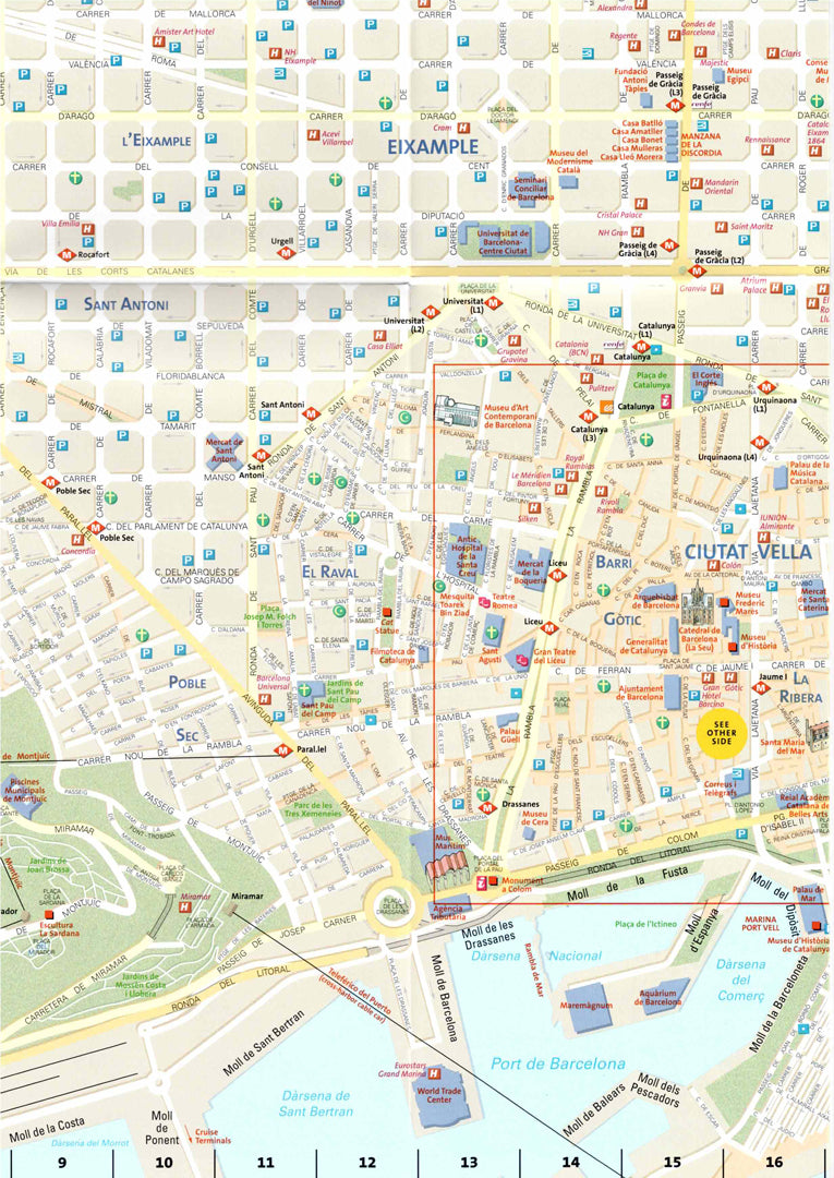
Barcelona Map
Barcelona Map
- Travel map
- Scale: 1:11,250
- National Geographic
Combining a clear city plan with a detailed travel guide, the Barcelona City Destination Map is perfect for visitors to Spain's popular coastal city. The map covers the city center from the neighborhoods of Les Cortes and Sants-Montjuic to Sant Martí, and includes hundreds of points of interest such as metro and train stations, historic buildings, parks, hospitals, and cultural sites.
Featuring prominent illustrations of major landmarks such as the Sagrada Familia and historic areas of the Old City (Ciutat Vella). The back features a regional map, a full metro map, a street and hotel index, and a diagram of Barcelona's airport. Printed on durable, waterproof and tear-resistant synthetic paper - ideal for easy and convenient navigation in the city.
Couldn't load pickup availability