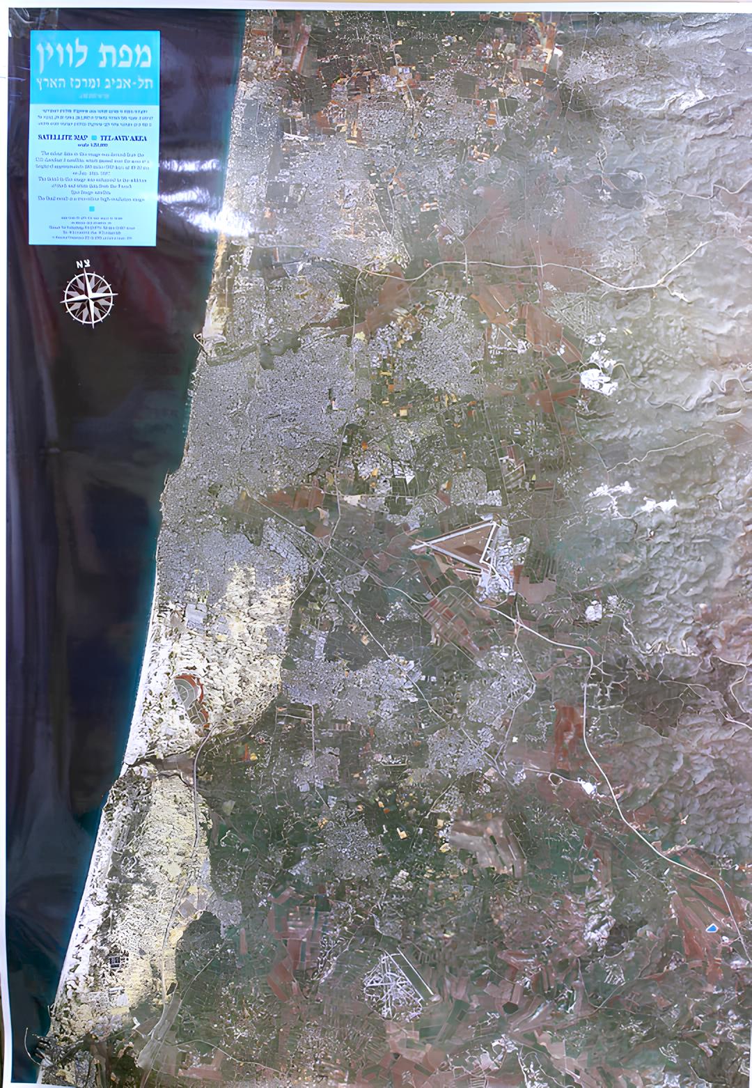
Satellite map of the Tel Aviv area and the center of the country
Satellite map of the Tel Aviv area and the center of the country
- Satellite map of the Tel Aviv area and the center of the country
- in the Hebrew language
- 100x70 cm
- Scale 1:50,000
- Photo from 1987
- Shmuel Tal Publishing
A satellite photo of the Tel Aviv area and the center of the country, which consists of color data received from the American Landsat-5 satellite, which passed over the area on January 18, 1987 at 9:30, at an altitude of about 930 km, and black and white data received from the French Spot Image satellite .
Regular price
120.00 ₪
Regular price
Sale price
120.00 ₪
Taxes included.
Shipping calculated at checkout.
Quantity
Couldn't load pickup availability