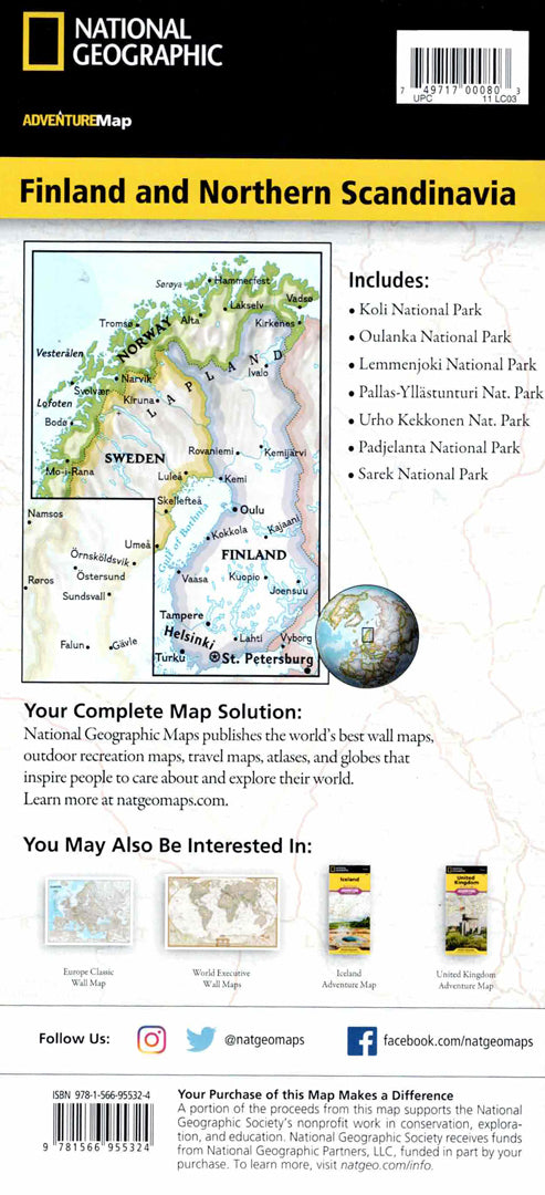
Map of Finland and Northern Scandinavia
Map of Finland and Northern Scandinavia
- Travel map
- Scale: 1:975,000
- National Geographic
A detailed travel map of Finland and Northern Scandinavia that includes areas in Northern Finland, Sweden and Norway.
The map shows many cities and towns alongside national parks, nature reserves, winter resorts, museums, castles and scenic lookout points. A complete road network with distances allows for easy planning of travel routes even in remote areas.
The map covers southern Finland to Rovaniemi in the north, the coast of northern Sweden and northern Norway to the shores of the Barents Sea and the Norwegian Sea.
Printed on extra strong synthetic paper — waterproof and tear-resistant — perfect for nature walks, driving in Northern Europe, and adventures in Lapland.
Suitable for:
• A trip to Finland and Lepland
• Exploring Northern Norway and Sweden
• Nature trips and national parks
• Route planning in Northern Europe
Couldn't load pickup availability