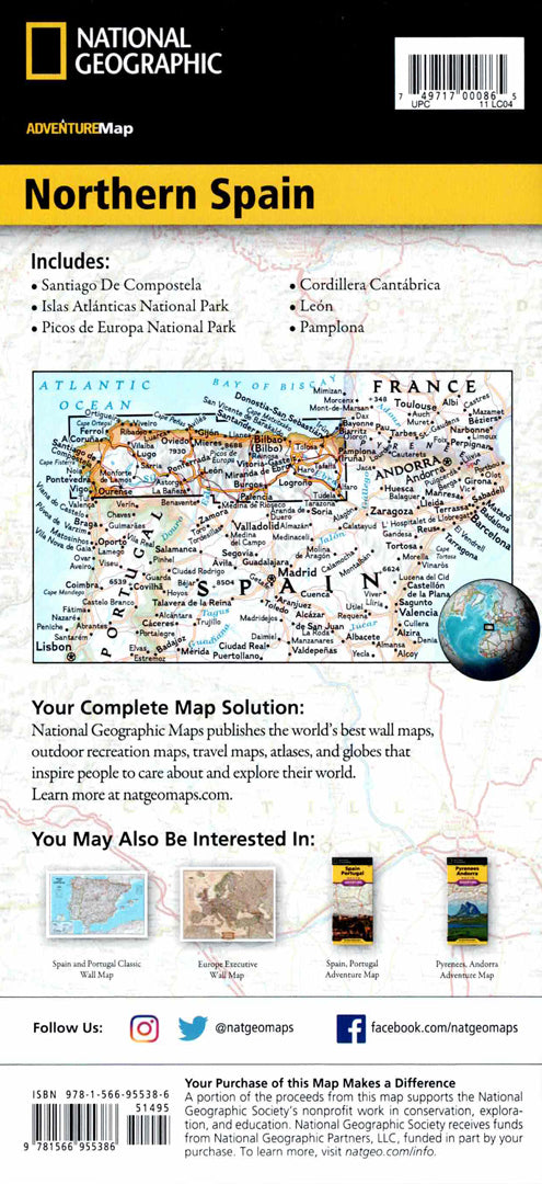
Map of Northern Spain – Camino de Santiago
Map of Northern Spain – Camino de Santiago
- Travel map
- Scale: 1:380,000
- National Geographic
A detailed hiking map of northern Spain, with clear markings of the Camino de Santiago route to the Cathedral of Santiago de Compostela in Galicia.
The map includes many cities and towns with an easy-to-use index, a road network marked with distances and road classifications, and natural, cultural, and historical sites along the way.
Printed on both sides:
The eastern part of northern Spain from the border with France to the center of the region on one side, and continuing west to the Atlantic coast on the other.
Suitable for:
• Walking the Camino route
• Planning treks in northern Spain
• Cultural tours in Galicia and the Basque Country
• Exploring historic cities and beaches
Printed on extra strong synthetic paper — waterproof and tear-resistant — perfect for extended use in the field.
Couldn't load pickup availability